Poster #107, Tectonic Geodesy
Comparison of ground-based and space-based surface rupture mapping of the May 15, 2020 M6.5 Monte Cristo Range earthquake, Nevada
Austin J. Elliott, Seth Dee, Rich D. Koehler, William D. Barnhart, Rich Briggs, Camille Collett, Timothy Dawson, Stephen DeLong, Ryan D. Gold, Elizabeth K. Haddon, Evan Hartsorn, Alexandra E. Hatem, Chris Milliner, Alexandra Pickering, Ian Pierce, Gordon G. Seitz, Charles Trexler, Chuck Wicks, Xiaohua Xu, & Judy Zachariasen


The poster PDF is private. For more information, please contact the author(s).
Poster Presentation
2020 SCEC Annual Meeting, Poster #107, SCEC Contribution #10489
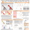
urface displacements reached >30 cm, visual continuity of InSAR fringes suggested initially that the fault slip was blind. Our field observations, however, showed discrete surface ruptures with 1-10 cm of offset throughout the region of highest strain, many at a high angle (~005-015° azimuth) to the left-lateral mainshock focal plane and alignment of aftershocks (~075°). Using products derived from the interferogram, including the unwrapped LOS displacements and phase gradients, we were able to recognize discrete surface ruptures in the field that had been hidden in the high fringe-rates near the projection of the main fault zone. To date, field teams have mapped tens of thousands of surface breaks along two principal ~060°-striking zones of 5 and 8 km length, respectively, as well as a wide range of additional surface slip along preexisting ~north-south extensional faults throughout the full ~30 km aftershock zone. A comparison of displacement across discontinuities in the unwrapped interferogram to locations and magnitudes of discrete surface offset in the field provides a holistic view of both the width of rupture zones and specific fault characteristics within the rupture zones (i.e., fracture orientation, slip sense, and offset). We find that both datasets are required to characterize deformation associated with this earthquake. This comparison provides a novel calibration of remote sensing to field observations, and reveals what portion of fault slip is manifested and preserved geomorphologically, helping us interpret seismic history and hazard from geological observations.
SHOW MORE
SHOW MORE
Citation: Elliott, A. J., Dee, S., Koehler, R. D., Barnhart, W. D., Briggs, R., Collett, C., Dawson, T., DeLong, S., Gold, R. D., Haddon, E. K., Hartsorn, E., Hatem, A. E., Milliner, C., Pickering, A., Pierce, I., Seitz, G. G., Trexler, C., Wicks, C., Xu, X., & Zachariasen, J. (2020, 08). Comparison of ground-based and space-based surface rupture mapping of the May 15, 2020 M6.5 Monte Cristo Range earthquake, Nevada. Poster Presentation at 2020 SCEC Annual Meeting.
Keywords: surface rupture, insar, SfM, coseismic rupture, Basin and Range
MORE POSTERS BY THE AUTHORS

|

|

|

|
|

|

|
|

|


MORE FROM TECTONIC GEODESY
|
|

|
|
|

|

|

|


