The SCEC CSM provides stress and stressing rate estimates across California, derived from various models and datasets and presented on a uniform grid, to give a more detailed picture of the SAFS stress regime.
New SCEC Community Stress Model Covers All of California
The SCEC Community Stress Model (CSM) now spans the entire San Andreas Fault System (SAFS), from Southern to Northern California. Leveraging a decade of collaborative research by dozens of SCEC scientists, the 2024 CSM release fills critical data gaps in Community Earth Models (CEMs) and aims to improve the characterization of in-situ stress states across California. This expanded statewide CSM is a valuable resource for researchers, enhancing hazard assessment and providing a more detailed understanding of the SAFS stress regime.
CSM: A Suite of Models of Stress and Stressing Rates
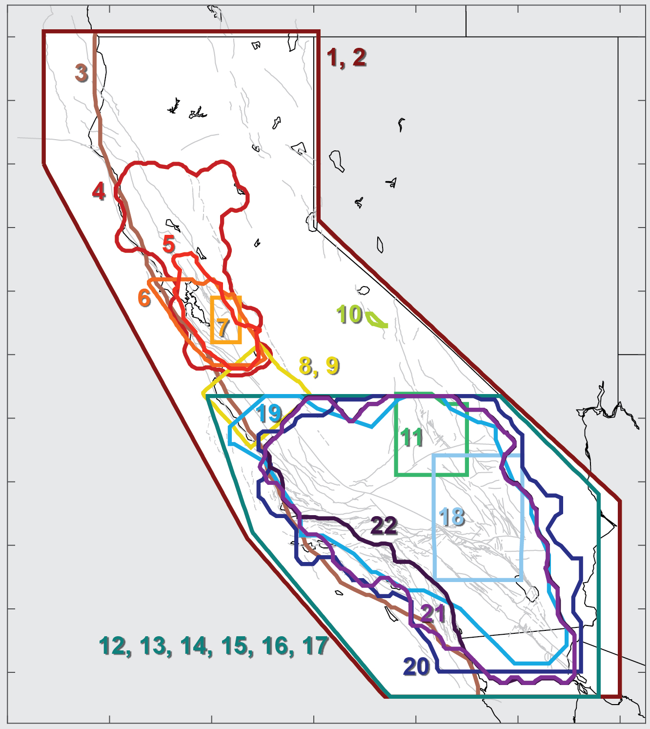
The SCEC Community Stress Model includes twenty-two distinct models, each based on different data types (e.g., focal mechanisms, borehole breakouts, geodetic data), methodologies (e.g., stress inversions, kinematic modeling), and underlying assumptions. These models, while covering subregions of California, collectively provide a more robust and nuanced representation of the region’s stress field. We welcome new and updated contributions of models of stress, stressing rate, or stress observations.
CEMs are collaborative platforms featuring community-contributed data, models, and tools for earthquake system analysis. CEMs enable 3D visualization, data exploration, sharing, and integrated analyses.
Community Stress Model (CSM) suite of stress and stressing rate models
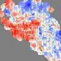
The CSM provides estimates of stress and stressing rates for various regions of California. The suite of models, derived using a variety of methods and datasets, are presented on a consistent grid.
Community Fault Model (CFM) 3D geometric representations of faults in California
CFM is an object-oriented, 3D representation of active faults in California, including geometries, depths, and slip potential. Explore and download data for use in fault system modeling, seismic hazard analyses, and many other applications.
Unified Community Velocity Model (UCVM) software for accessing seismic velocity models
A standard interface to multiple seismic velocity models that can be used to create velocity meshes for 3D wavefield simulations. UCVM is used by researchers working with Earth material properties on regional or local scales.
Community Geodetic Model (CGM) Earth surface displacement from GNSS and InSAR
The CGM integrates high-precision GNSS and InSAR data to provide velocities and time series of Earth’s surface movements. Data comes from a number of contributing researchers, institutions and analysis centers.
Community Rheology Model (CRM) 3D ductile rheology of lithosphere in California
The CRM provides a detailed, physics-based 3D model of ductile rheology (rock flow) for Southern California’s lithosphere. The explorer provides an interface to query temperature, pressure, and rheology data.
Community Thermal Model (CTM) estimates of temperature and thermal properties
The CTM provides estimates of temperatures and thermal properties of the southern California lithosphere and asthenosphere. Currently, the CTM includes two models, each based on different methods.
Geologic Slip Rate Database (GSRD) geologic slip rates for CA, NV, and northern Mexico
SCEC’s GSRD centralizes field-derived geologic slip rates crucial for seismic hazard estimates (e.g., NSHM), linked to relevant source publications. As a living archive, it welcomes updates via a user submission form.
Precariously Balanced Rock (PBR) Database field-derived data for PBRs in California
The database contains photographs, locations, and metadata for PBRs, valuable for constraining seismic hazard estimates and validating ground motion predictions. An interactive map viewer facilitates data exploration and querying.
SCEC CSM to facilitate comparisons of stress from different facets of the earthquake problem
The SCEC CSM defines the shape and size of the existing stress field around faults, while measurements of “stress drop” estimate how much stress was relieved during an earthquake. Improving techniques and coordination with efforts such as the Community Stress Drop Validation Study will enable comparisons and validation to better understand the SAFS stress regime.
Future research aims to make the CSM stressing rate model consistent with the statewide CGM
The SCEC Community Geodetic Model (CGM) integrates high-precision GNSS and InSAR data to provide displacement and velocity timeseries of Earth’s surface movements. A research target for future CSM stressing rates will be based on new results from the statewide CGM to develop better and internally consistent CEM models for earthquake research.
SCEC Community Stress Model: Latest Release (v2024)
Researchers Karen Luttrell, Liz Hearn, and Jeanne Hardebeck leveraged existing research products and community expertise in stress modeling, strain rate analysis, and cyberinfrastructure development to enhance the CSM. They established a unified 3D grid to allow for the insertion of new stress orientation data over the entire SAFS. The use of pre-existing Western U.S. deformation rate models enabled rapid calculation of the new statewide stressing rate estimations. LEARN MORE
Key Technical Developments
The SCEC CSM v2024 integrates diverse datasets, including stress orientation, stress accumulation rates, and estimates of stress magnitudes. Key technical developments include:
Statewide 3D Grid Definition: A unified 3D grid framework was established to facilitate consistent spatial referencing across the entire SAFS for all model components.
Focal Mechanism Inversion Data Integration: Existing focal mechanism inversion models of stress orientation from Northern California and surrounding regions were incorporated to expand the spatial coverage of stress orientation data.
Statewide Stressing Rate Estimation: New statewide stressing rate estimates were derived from existing Western U.S. deformation rate models to provide critical constraints on stress accumulation across the SAFS.
Formal CSM Contribution Integration: The acquired stress orientation and stressing rate models were integrated as official CSM contributions, following established data standards and formats.
Enhanced Data Accessibility: The updated CSM data is available through the CSM permanent archive and web-based explorer tool, facilitating its use by the research community.
For those interested in the SCEC CSM project and contributing, the background page offers essential information to get started.
Derived Metrics for Stress Orientation or Magnitude
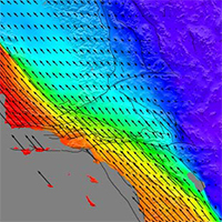
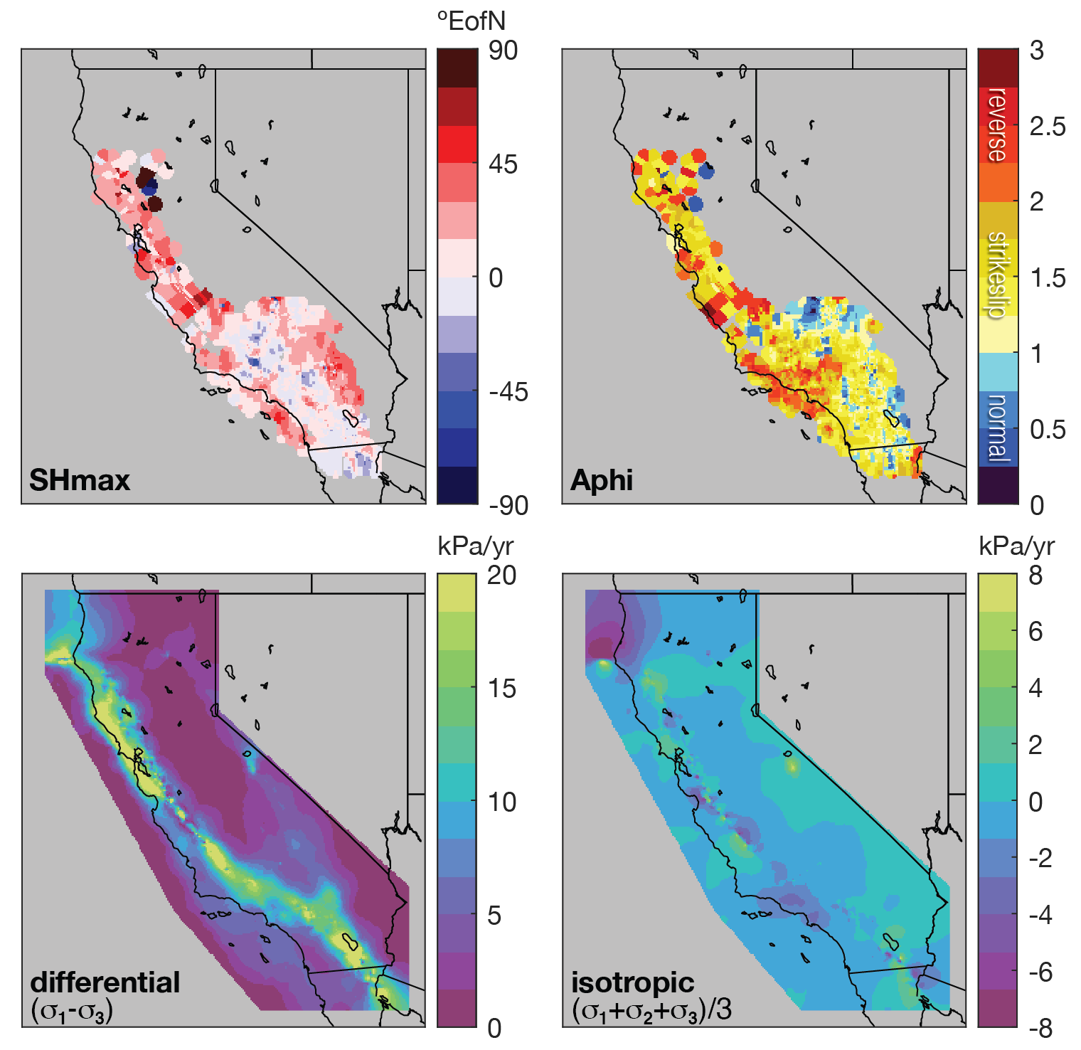
SCEC CSM data includes 6-component 3D stress or stressing-rate tensor values, principal stress values, principal axis orientations, and derived stress metrics (e.g. SHmax, Aphi, Isotropic pressure, Differential stress).
Open-Source Software and FAIR Data
The Statewide California Earthquake Center (SCEC) prioritizes access to its software tools and data by both the scientific community and the public. Through open-source software and FAIR (Findable, Accessible, Interoperable, Reusable) data practices, we strive for SCEC software and data to remain discoverable, usable, and citable for future research.
Proper Acknowledgement & Citations
To ensure proper credit for the development and use of SCEC Community Earth Models, we kindly request that you cite the specific model(s) you utilize in your research or for other applications. This helps track usage and acknowledge the contributions of the many model developers and researchers, who have invested significant effort and expertise to advance SCEC Community Earth Models.
Most models have Digital Object Identifiers (DOIs) on Zenodo. Use the links below to find the appropriate citation: