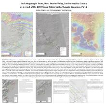
Fault mapping in Trona, West Searles Valley, San Bernardino County, California as a result of the 2019 Trona-Ridgecrest Earthquake Sequence, Part 2
Frank F. Jordan, Jr., & Miles H. WagnerSubmitted September 11, 2022, SCEC Contribution #12468, 2022 SCEC Annual Meeting Poster #105 (PDF)
The 2019 Trona-Ridgecrest Earthquake Sequence occurred primarily as a result of shallow fault rupture initially along the northeast-striking Salt Wells Valley Faults and subsequently along the northwest-striking Paxton Ranch Faults. However, extensive damage to Trona, Argus, West End, Windy Point, and Searles Lake areas of San Bernardino County as the result of strong ground shaking suggested the presence of additional faulting in Searles Valley. Field reconnaissance along Trona Road found the presence of west-striking, primary fault rupture in the vicinity of West End on July 4 and 5, 2019 (the Miles Fault). Originally classified by the State as a liquefaction/lateral spread feature, subsequent field mapping by the Searles Valley Working Group (SVWG) documented ground surface rupture across the floors and walls of former gravel quarries and along the edge of the unlined Miles Canyon County Flood Control Channel approximately 1.5 kilometers (1 mile) to the west of Trona Road, up the dry canyon. Additional north- and northeast- striking primary faulting was mapped in downtown Trona (the Trona Fault) and at Windy Point (the Aguirre Ranch Fault). At least seven additional primary fault ruptures were identified in the West Searles Valley (including the West Searles Valley Faults, Randsburg Wash Road Fault, Pinnacles Road Fault, Railroad Faults, Ana's Fault, Jessie's Fault, and Outhouse Fault). It is proposed that all of these faults be included within State A-P Zones.
All of these faults were found as pixelated, linear traces on overlay X and Y phase gradient imagery provided by Xu (2019). These traces matched interferogram imagery, also from Xu (2019). The traces of surface faulting were mapped by the authors and volunteers of the SVWG utilizing Garmin GPS units. The data was downloaded from the units and added to field maps using Garmin Software ver. 7. The correlation between fault traces mapped by the SVWG with potential high-angle fault surface disturbances displayed by Xu was considered sufficiently well matched that field mapping to areas previously considered unfaulted were scheduled. Based on the imagery of Xu (2019), field trothing found corroborating evidence for the ground surface ruptures previously suggested by Xu. The correlation between high-angle fault disturbances on Xu's imagery and mapped surface fault ruptures, the authors propose that zonation for active faulting be based solely upon disturbances captured by Xu.
Key Words
Trona, Searles Valley, Fault, Surface Rupture, X-Phase and Y-Phase Gradient Map, Interferogram
Citation
Jordan, Jr., F. F., & Wagner, M. H. (2022, 09). Fault mapping in Trona, West Searles Valley, San Bernardino County, California as a result of the 2019 Trona-Ridgecrest Earthquake Sequence, Part 2. Poster Presentation at 2022 SCEC Annual Meeting.
Related Projects & Working Groups
Earthquake Geology


