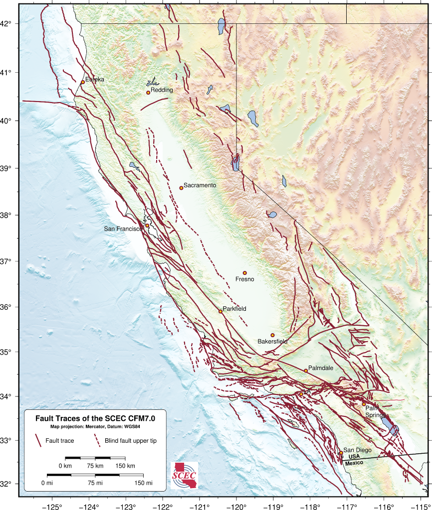
The SCEC Community Fault Model (CFM) is an object-oriented, fully 3D geometric representation of active faults in California, adjacent offshore basins, and surrounding regions.
The SCEC Community Fault Model (CFM) is a comprehensive, 3D geometric representation of active faults in California and surrounding regions, developed over decades with hundreds of contributors. It integrates seismicity, surface traces, borehole logs, seismic profiles, and geologic cross-sections into detailed 3D fault surfaces and metadata. Widely used in fault system modeling, ground motion prediction, and hazard assessment, the CFM and its Explorer tool help users examine fault geometry and interact with real-world data.
Comparison of Different Fault Models for California
Several fault models contribute to our understanding of California’s earthquake hazards. The USGS Quaternary Fault and Fold Database provides detailed 2D surface traces and fault activity information. The National Seismic Hazard Map incorporates simplified 2.5D fault representations optimized for hazard analysis. Distinct from these efforts, the SCEC Community Fault Model offers a fully 3D, data-constrained view of fault geometry, supporting a broad range of scientific and engineering applications across the SCEC community.
CEMs are collaborative platforms featuring community-contributed data, models, and tools for earthquake system analysis. CEMs enable 3D visualization, data exploration, sharing, and integrated analyses.
Community Fault Model (CFM) 3D geometric representations of faults in California
CFM is an object-oriented, 3D representation of active faults in California, including geometries, depths, and slip potential. Explore and download data for use in fault system modeling, seismic hazard analyses, and many other applications.
Community Stress Model (CSM) suite of stress and stressing rate models
The CSM provides estimates of stress and stressing rates for various regions of California. The suite of models, derived using a variety of methods and datasets, are presented on a consistent grid.
Unified Community Velocity Model (UCVM) software for accessing seismic velocity models
A standard interface to multiple seismic velocity models that can be used to create velocity meshes for 3D wavefield simulations. UCVM is used by researchers working with Earth material properties on regional or local scales.
Community Geodetic Model (CGM) Earth surface displacement from GNSS and InSAR
The CGM integrates high-precision GNSS and InSAR data to provide velocities and time series of Earth’s surface movements. Data comes from a number of contributing researchers, institutions and analysis centers.
Community Rheology Model (CRM) 3D ductile rheology of lithosphere in California
The CRM provides a detailed, physics-based 3D model of ductile rheology (rock flow) for Southern California’s lithosphere. The explorer provides an interface to query temperature, pressure, and rheology data.
Community Thermal Model (CTM) estimates of temperature and thermal properties
The CTM provides estimates of temperatures and thermal properties of the southern California lithosphere and asthenosphere. Currently, the CTM includes two models, each based on different methods.
Geologic Slip Rate Database (GSRD) geologic slip rates for CA, NV, and northern Mexico
SCEC’s GSRD centralizes field-derived geologic slip rates crucial for seismic hazard estimates (e.g., NSHM), linked to relevant source publications. As a living archive, it welcomes updates via a user submission form.
Precariously Balanced Rock (PBR) Database field-derived data for PBRs in California
The database contains photographs, locations, and metadata for PBRs, valuable for constraining seismic hazard estimates and validating ground motion predictions. An interactive map viewer facilitates data exploration and querying.
Integrating seismic catalogs with 3D fault models for rapid association
The Community Fault Model (CFM) earthquake-to-fault associations service provides near real-time statistical links between M≥3 events in the Southern California Seismic Network (SCSN) earthquake catalog and likely faults in the SCEC Community Fault Model. Based on Evans et al. (2020), the service utilizes the latest CFM and integrates with the CFM Explorer, supporting rapid response efforts.
Advancing ground motion modeling through unified structural representations
The SCEC CFM, integrated with the Community Velocity Model (CVM), enables more realistic 3D simulations of earthquake processes. This unified structural framework supports seismic hazard analysis, ground motion prediction, and research by linking fault geometry with subsurface velocity structure—critical for modeling how earthquakes initiate and propagate through complex Earth materials.
The CFM aims to continuously improve the inventory of faults throughout the wider San Andreas fault system including:
Refining existing fault representations by integrating new source data.
Adding new faults when appropriate following CFM community evaluation.
Evaluating new methods to facilitate creation of new fault representations.
Ensuring compatibility and accessibility for a wide range of research and education tasks.
The SCEC Community Fault Model v7.0 covers all of California
Scott Marshall presented the SCEC CFM v7.0 at the 2025 USGS Northern California Earthquake Hazards Workshop, highlighting its expanded statewide coverage of California’s known active faults.
Community Evaluation and Objective Analyses of SCEC CFM
The SCEC CFM routinely undergoes expert review to guide revisions. To assess model completeness, CFM developers use a statistical method (Evans et al., 2020) that links earthquakes to faults using independent data. This helps evaluate how well the latest CFM explains past earthquakes compared to earlier versions and other fault models like the USGS NSHM. The goal is to provide a quantitative and objective measure of completeness and identify potentially missing or inaccurate fault information.
SCEC Community Fault Model: Latest Release (version 7.0)
The SCEC Community Fault Model (CFM), version 7. 0, builds on previous versions and represents the latest update to Plesch et al. (2007). For the first time, the CFM provides statewide coverage of California’s active faults, extending from northern Mexico to the southern Cascadia subduction zone. While the southern California portion remains unchanged from version 6.1, CFM 7.0 introduces 113 new fault representations in central and northern California. These additions undergone community evaluation and we are working on related updates. LEARN MORE
Key Technical Developments
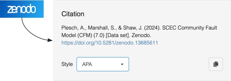
The SCEC CFM 7.0, including all sub-models, comprises 608 fully documented fault objects. It includes three sub-models: Preferred, Ruptures, and Alternatives. All together, the sub‑models capture competing structural interpretations with potential impacts on hazard estimates. When using the SCEC CFM, please cite both Plesch et al. (2007) and the archived model DOI.
For those interested in the SCEC CFM project and contributing, the background page offers essential information to get started.
Current CFM sub-models:
CFM 7.0 Preferred: A set of 556 fault objects representing the current best understanding of active faults, based on prior community evaluations or newly added representations.
CFM 7.0 Ruptures: A subset of 13 fault objects assembled from the Preferred model that were involved in selected significant historic events. These are not earthquake source models, but representations of the full fault surfaces that experienced major ruptures. This model helps identify which CFM fault objects correspond to those notable events.
CFM 7.0 Alternatives: A set of 39 alternative representations where structural differences have been proposed that could significantly impact fault mechanics and associated seismic hazards. These alternatives were dominantly based on community rankings following the May 2022 comprehensive evaluation of the SCEC CFM.
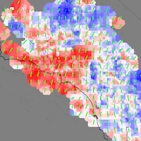
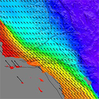
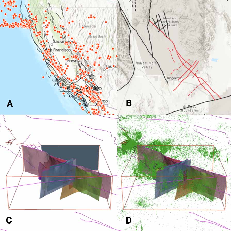
Interactively explore faults in 2D or 3D using any version of the SCEC CFM. Overlay fault objects with historic earthquakes (A) or other seismicity data (D), visualize selected faults as 3D surfaces at depth (B-D), or upload your own datasets for direct comparison.
Open-Source Software and FAIR Data
The Statewide California Earthquake Center (SCEC) prioritizes access to its software tools and data by both the scientific community and the public. Through open-source software and FAIR (Findable, Accessible, Interoperable, Reusable) data practices, we strive for SCEC software and data to remain discoverable, usable, and citable for future research.
Proper Acknowledgement & Citations
To ensure proper credit for the development and use of SCEC Community Earth Models, we kindly request that you cite the specific model(s) you utilize in your research or for other applications. This helps track usage and acknowledge the contributions of the many model developers and researchers, who have invested significant effort and expertise to advance SCEC Community Earth Models.
Most models have Digital Object Identifiers (DOIs) on Zenodo. Use the links below to find the appropriate citation: